What are the main weather changes expected across Greece?
A noticeable decline in temperatures serves as the primary characteristic of the weather on Thursday, November 5, 2026. Meteorological services, including EMY and meteo, report that cloud cover will be widespread, bringing localized rainfall to several regions. The most significant thermal shifts are anticipated in the northern parts of the country, where the cooling effect will be most pronounced.
Cloudy conditions with local showers are expected in Macedonia, Thessaly, eastern Sterea, Euboea, the eastern Peloponnese, the Cyclades, and Crete. In Thrace, cloud cover and rain are specifically expected during the morning hours. Other regions may experience transient increases in cloudiness without significant precipitation. Visibility is also expected to be limited, particularly during the morning and evening hours in western mainland areas due to the formation of fog.
Regional temperature distribution
The temperature variations across the Greek territory are diverse. In the north, temperatures are forecasted to reach between 14°C and 16°C. Western regions will remain warmer, with highs between 20°C and 21°C. Most other parts of the country will see temperatures ranging from 17°C to 20°C, while the southeast is expected to be the warmest, reaching 22°C to 23°C. Specific localized variations in Western Macedonia could see lows as low as 1°C, while the Aegean islands may fluctuate between 10°C and 17°C depending on their exact location.
Where will snowfall and heavy rain occur?
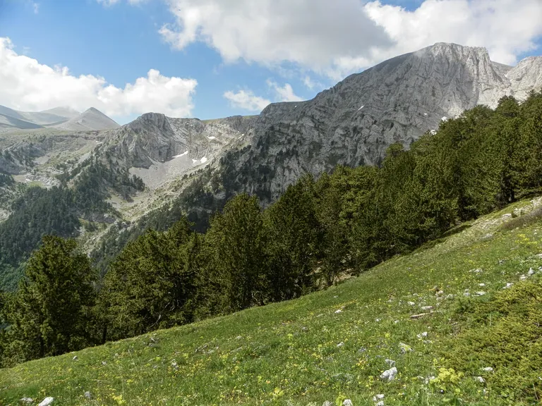
Snowfall is predicted for high-altitude mountainous areas, specifically at elevations above 1800 meters. While much of the country will experience rain, the intensity and frequency vary by geography. According to meteo, rainfall will be intermittent and localized across several mainland sections and Crete.
Specific areas identified for rainfall include:
- Central, eastern, and northern mainland regions
- The Peloponnese peninsula
- Euboea
- Crete
- The Sporades and Cyclades (where rain may be lighter and more transient)
The combination of falling temperatures and moisture will result in snow accumulation in the mountains, marking a transition toward winter conditions in the higher elevations. Travelers and residents in these areas should prepare for slippery conditions and reduced visibility.
How will wind and visibility affect travel conditions?
Wind speeds and visibility are key factors that may impact maritime and road travel today. Winds in the western parts of the country are expected to be variable, ranging from 3 to 5 Beaufort. In contrast, the eastern regions will face northerly winds with intensities between 4 and 6 Beaufort, while the Aegean Sea could see gusts reaching up to 7 Beaufort.
Visibility concerns are specifically highlighted for the following periods and locations:
- Morning and Evening: Reduced visibility and fog are expected in the central and northern parts of the country.
- Western Mainland: Localized limitations in visibility are anticipated during the early and late hours.
- Aegean Sea: Strong northerly winds may impact maritime visibility and sea conditions.
The combination of fog in the north and strong winds in the Aegean suggests that both land and sea transport may encounter delays or require increased caution.
What is the specific outlook for Attica and Thessaloniki?
Attica and Thessaloniki will experience distinct weather patterns characterized by cloudiness and localized showers. In Attica, clouds are expected to bring a high probability of light rain, particularly in the northern parts of the prefecture, lasting until midday. Wind conditions in Attica will be northerly, with strengths of 4 to 5 Beaufort, though some eastern and southeastern areas may experience stronger gusts of up to 6 Beaufort. Temperatures in Attica are forecasted to range between 11°C and 17-18°C.
In Thessaloniki, the weather will consist of light rain occurring locally and intermittently. Similar to the northern regions, Thessaloniki is expected to experience fog during the night and early morning hours. Winds in the Thessaloniki area will be variable and light. The temperature in the center of Thessaloniki is expected to fluctuate between 11°C and 14°C.
Summary of temperature ranges by region
| Region | Temperature Range (°C) |
|---|---|
| Western Macedonia | 1°C to 9-11°C |
| Macedonia & Thrace | 4°C to 12-14°C |
| Epirus | 6°C to 18°C |
| Thessaly | 6°C to 15-16°C |
| Other Mainland | 8°C to 17-18°C |
| Ionian Islands | 10°C to 18-20°C |
| North/Northeast Aegean | 10°C to 15-17°C |
| South Aegean & Crete | 13°C to 19-20°C |
Frequently asked questions
Will it snow in Greece today?
Snow is expected to fall in mountainous regions where the altitude exceeds 1800 meters. While most of the country will experience rain or cloudiness, the higher elevations will see snow due to the significant drop in temperatures across the northern and central parts of the country.
How strong are the winds in the Aegean?
Winds in the Aegean Sea are expected to be relatively strong, blowing from northerly directions with intensities of 5 to 6 Beaufort. In some areas, these winds may reach up to 7 Beaufort, which could affect maritime activities and sea conditions.
What should I expect in Attica regarding rain and wind?
In Attica, you can expect cloudy skies with a high likelihood of light rain, especially in the northern parts of the prefecture, until midday. Winds will generally be northerly at 4 to 5 Beaufort, but may reach 6 Beaufort in the eastern and southeastern sectors.
Is visibility a concern for drivers?
Yes, visibility may be limited during the morning and evening hours. Fog is specifically expected in the central and northern parts of Greece, as well as in the western mainland areas, which could impact road safety and travel times.
How much will the temperature drop?
The temperature drop is described as significant, particularly in the north. In Western Macedonia, lows could reach as little as 1°C, while most other regions will see temperatures ranging between 14°C and 23°C depending on their specific geographic location.
Key takeaways
- Significant temperature drops are expected, particularly in northern Greece.
- Snowfall is predicted for mountain areas above 1800 meters elevation.
- Localised rainfall will affect Macedonia, Thessaly, Crete, and the Peloponnese.
- Fog and reduced visibility are expected in northern and western regions.
- Strong northerly winds up to 7 Beaufort may impact the Aegean Sea.
Conclusion
The weather pattern for November 5, 2026, marks a clear shift toward cooler, more unsettled conditions across Greece. With significant temperature declines, especially in the north, and the onset of snow in high-altitude regions, residents and travelers should prepare for varied weather impacts. The combination of localized rainfall, potential fog in central areas, and gusty winds in the Aegean necessitates caution, particularly for maritime transport and early morning commutes. Monitoring local meteorological updates remains essential as the transition to colder seasonal weather progresses.