Why is the temperature dropping across Greece?
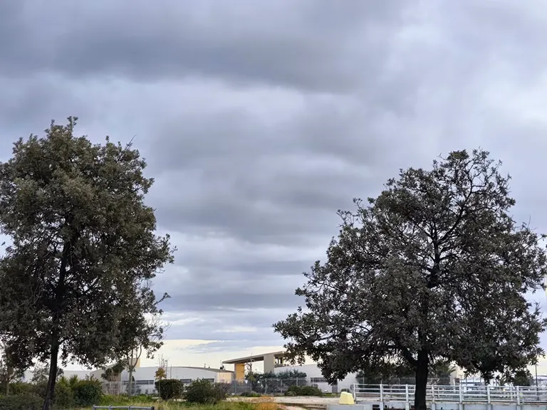
A cooling trend is affecting much of the Greek mainland and islands as of Friday, November 6, 2026. Meteorological data indicates that the temperature decline is most pronounced in the central parts of the country, though southern and eastern regions are also seeing a downward shift in thermal values. This transition is characterized by a mix of cloud cover and intermittent weather changes that define the early November period.
The temperature fluctuations vary significantly depending on the geographical zone. For instance, while some areas maintain relatively mild conditions, others will experience much sharper drops. This cooling is accompanied by increased cloudiness, which is expected to persist throughout the day, influencing both daytime highs and nighttime lows across the various administrative regions of Greece.
Regional temperature variations
The degree of cooling is not uniform. In Western Macedonia, temperatures are expected to range from a low of 1°C to a maximum of approximately 9-11°C. In contrast, the Peloponnese remains warmer, with expected values between 6°C and 18-19°C. Other regions such as Epirus will see temperatures between 5°C and 16-17°C, while Thessaly will fluctuate between 5°C and 14-16°C. These variations highlight the diverse microclimates present during this seasonal transition.
Where will it rain in Greece on November 6?
Localized rainfall is expected in several specific regions throughout the day. According to EMY, intermittent clouds and light local rains are anticipated in Western and Central Macedonia, Eastern Thessaly, Eastern Sterea, Euboea, the eastern and southern Peloponnese, and Crete. These showers are expected to be transient, primarily occurring until the afternoon hours.
Meteo's analysis provides additional detail, suggesting that while the rain will be light and of a local character, it may become denser in certain areas and during specific intervals. The forecast highlights that early morning showers are most likely in the eastern mainland, extending into the southern Peloponnese, Kythira, and Western Crete. These precipitation events are expected to be scattered rather than continuous across the entire landmass.
What are the wind and visibility conditions?
Wind conditions are set to be quite active, particularly in the maritime regions. In the Aegean Sea, northerly winds are expected to reach intensities of 5 to 6 Beaufort, with local gusts potentially reaching 7 Beaufort. In the southern and coastal parts of Crete, winds may reach 6 Beaufort. In the Ionian islands, winds will be northwesterly with intensities of 3 to 4 Beaufort, while coastal areas of the Ionian will experience easterly winds at similar speeds.
Visibility is another critical factor for travelers and commuters. Both EMY and Meteo warn of limited visibility and the formation of fog during the night and early morning hours, especially across the mainland. These conditions could impact road safety and maritime navigation in the affected areas.
Wind intensity by region
| Region | Wind Direction | Intensity (Beaufort) |
|---|---|---|
| Aegean Sea | Northern | 5-7 |
| Ionian Islands | Northwestern | 3-4 |
| Ionian Coast | Eastern | 3-4 |
| Western Greece | Variable | 3-4 |
| Crete (Coastal) | Northern/Local | 6 |
How will the weather affect Attica and Thessaloniki?
Major urban centers like Attica and Thessaloniki will experience relatively stable but cloudy conditions. In Attica, the forecast predicts a few clouds that may increase periodically. Localized light drizzle is possible during the morning hours. Temperatures in the Attica region are expected to range between 10°C and 15-16°C, with northerly winds blowing at 3 to 4 Beaufort, occasionally reaching 5 Beaufort in the eastern and southeastern parts of the prefecture.
Thessaloniki will see similar cloud cover, with a specific warning regarding visibility. Fog is expected to form in the city and its surrounding prefecture during the night and early morning. Temperatures in central Thessaloniki are projected to stay between 9°C and 14°C. Winds in the Thessaloniki area are expected to be light and variable, posing less of a challenge than the winds in the Aegean.
What is the full temperature breakdown by region?
To assist with planning, the following temperature ranges have been identified for November 6, 2026, based on the latest meteorological assessments:
- Western Macedonia: 1°C to 9-11°C
- Macedonia and Thrace: 2°C to 13-15°C
- Epirus: 5°C to 16-17°C
- Thessaly: 5°C to 14-16°C
- Peloponnese: 6°C to 18-19°C
- Eastern Mainland: 8°C to 14-16°C
- Ionian Islands: 10°C to 17-18°C
- North/Northeast Aegean Islands: 8°C to 14-15°C
- Other Aegean Islands and Crete: 10°C to 17-19°C
Frequently asked questions
Will there be heavy rain today?
No, the forecast indicates that rainfall will be light and of a local character. While some areas may experience denser precipitation during certain intervals, the rain is expected to be intermittent and transient rather than heavy or continuous across the country.
How cold will it get in Macedonia?
Temperatures in Western Macedonia will be significantly lower than in the south, ranging from a minimum of 1°C to a maximum of 11°C. The rest of Macedonia and Thrace will see slightly warmer ranges, between 2°C and 15°C.
Is it safe to travel in the Aegean?
Travelers should be cautious due to strong northerly winds in the Aegean, which can reach 7 Beaufort. Additionally, localized fog and limited visibility during the night and early morning may affect both maritime and road travel in certain mainland areas.
What is the weather like in Athens?
Attica, where Athens is located, will experience temperatures between 10°C and 16°C. The sky will be partly cloudy with a possibility of light drizzle in the morning, and winds will be relatively moderate at 3 to 5 Beaufort.
Will there be fog in Thessaloniki?
Yes, Thessaloniki is expected to experience fog during the night and early morning hours. This will likely lead to limited visibility, so residents should exercise caution when driving during these times.
Key takeaways
- Temperatures will drop across Greece, particularly in central and northern regions.
- Light, localized rain is expected in Macedonia, Thessaly, and the Peloponnese.
- Strong northerly winds up to 7 Beaufort will affect the Aegean Sea.
- Fog and limited visibility are predicted for the mainland during night and early morning.
- Attica and Thessaloniki will remain relatively mild with temperatures between 9°C and 16°C.
Conclusion
The weather pattern for November 6, 2026, marks a transition toward cooler, more unsettled autumn conditions across Greece. With temperature drops reaching as low as 1°C in Western Macedonia and localized rain affecting various regions, residents should prepare for a change in climate. While major cities like Athens and Thessaloniki remain relatively mild, the strong winds in the Aegean and the potential for fog on the mainland necessitate caution for maritime and road travel. Monitoring local updates from EMY and Meteo remains advisable as these transient weather systems move through the country.