Why was the 112 emergency alert sent to Rhodes?
The 112 emergency alert was triggered by the imminent arrival of intense meteorological phenomena that pose a direct risk to public safety on the island of Rhodes. Dispatched at 03:30 on Monday, November 2, 2026, the message served as a critical warning to both the local population and the influx of tourists currently visiting the Dodecanese island.
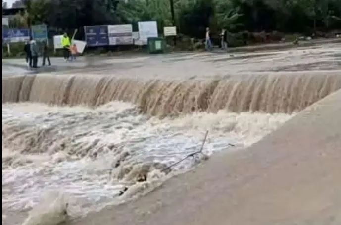
According to reports from the Athens News Agency (ΑΠΕ), the primary driver for this emergency communication is the expectation of heavy rainfall and significant storm activity. The alert specifically instructs individuals to restrict their movements and to remain vigilant by following the directives issued by the competent Greek authorities. This preemptive measure is designed to prevent accidents or injuries resulting from flash flooding, reduced visibility, or structural damage caused by severe weather.
The role of the 112 emergency system
The 112 system in Greece functions as a vital tool for Civil Protection, allowing for the rapid dissemination of life-saving information to specific geographic areas. In the context of the Rhodes warning, the system ensures that even visitors who may not be familiar with local topography or weather patterns receive immediate, standardized instructions to seek shelter or avoid high-risk zones.
What are the specific weather forecasts for the region?
Meteorological data indicates that Rhodes and the surrounding Dodecanese islands will face intermittent periods of severe weather lasting until late Monday night. The forecast highlights a transition from disorganized local showers to a more structured and intense weather system as the week progresses.
According to Meteo, the region is being impacted by successive barometric systems that will maintain unfavorable weather conditions at least through Tuesday. The key characteristics of this weather event include:
- Heavy localized rainfall: Intense downpours are expected to cause rapid water accumulation.
- Storm activity and hail: Thunderstorms accompanied by hail are predicted, particularly in coastal and maritime areas.
- Increased wind speeds: Wind intensity is expected to rise, potentially affecting maritime stability and coastal safety.
Meteorologist Thodoris Kolydas noted that while the weather had not initially appeared as a fully organized storm system, the situation is expected to escalate significantly on Tuesday and Wednesday. This escalation is due to an upper-level low-pressure system approaching the region, which will intensify the existing meteorological phenomena.
How does the weather impact other parts of Greece?
The severe weather pattern is not confined to the Dodecanese; it represents a broader meteorological event affecting multiple regions across the Greek archipelago. The Hellenic National Meteorological Service (EMY) has issued updated emergency bulletins outlining the progression of these storms across different zones.
The distribution of the weather phenomena is scheduled as follows:
| Region | Expected Timing | Primary Characteristics |
|---|---|---|
| Ionian Islands | From midday Monday | Heavy rain and thunderstorms |
| Peloponnese (Western/Southern) | From afternoon Monday | Coastal storms and heavy rain |
| Mainland (Epirus/Western Central) | From afternoon Monday | Intense rainfall and storms |
| Dodecanese (including Rhodes) | Through late Monday night | Intermittent heavy storms and hail |
This widespread pattern suggests a significant atmospheric disturbance moving across the country, requiring heightened readiness from local authorities in various prefectures.
What safety instructions must residents and visitors follow?
The Greek Civil Protection authority has issued strict guidelines to minimize the risk of casualties and property damage during the storm. The core instruction for all individuals in Rhodes is the immediate limitation of non-essential travel.
Safety protocols include:
- Avoid unnecessary travel: Stay indoors during peak storm periods to avoid risks from falling objects, flooding, or hydroplaning.
- Adhere to official directives: Monitor official government channels and local news for real-time updates from the Civil Protection and local municipalities.
- Maritime caution: Due to the forecast of increased winds and heavy seas, maritime activities should be suspended or approached with extreme caution.
- Coastal awareness: Residents in coastal areas should be particularly mindful of potential surges or sudden increases in sea levels during heavy rainfall.
By following these instructions, the public can significantly reduce the likelihood of being caught in dangerous situations, such as being trapped by rising waters or being exposed to lightning and hail in open areas.
Frequently asked questions
What time was the emergency alert sent to Rhodes?
The emergency alert was sent via the 112 system at 03:30 on Monday, November 2, 2026. This early morning notification was intended to provide residents and visitors with sufficient time to prepare for the incoming severe weather conditions throughout the day.
How long is the bad weather expected to last?
According to meteorological forecasts, the unfavorable conditions are expected to persist at least until Tuesday. However, meteorologist Thodoris Kolydas warns that the weather will likely intensify on Tuesday and Wednesday as an upper-level low-pressure system approaches the Greek region.
What specific weather phenomena are expected in Rhodes?
Rhodes is expected to experience heavy localized rainfall, thunderstorms, and hail. Additionally, there is a forecast for increased wind speeds, particularly in coastal and maritime areas, which may impact visibility and travel safety across the island.
What should I do if I am a visitor in Rhodes?
Visitors should immediately limit their movements and avoid unnecessary travel. It is crucial to follow all instructions provided by the local authorities and Civil Protection. Staying indoors and monitoring local weather updates is the most effective way to remain safe during the storm.
Is the storm affecting other parts of Greece?
Yes, the weather system is affecting several regions. The Ionian Islands, parts of the Peloponnese, and the mainland (including Epirus and Western Central Greece) are also under weather warnings for heavy rain and thunderstorms, according to the Hellenic National Meteorological Service.
Key takeaways
- A 112 emergency alert was issued to Rhodes at 03:30 on November 2, 2026.
- Authorities advise residents and visitors to limit all non-essential travel immediately.
- Severe weather includes heavy rain, thunderstorms, hail, and increased wind speeds.
- Weather conditions are expected to intensify on Tuesday and Wednesday due to a low-pressure system.
Conclusion
The severe weather warning for Rhodes underscores a significant meteorological event that requires immediate caution from all individuals on the island. With the 112 emergency alert providing a critical early warning, the focus remains on minimizing movement and adhering to the guidance of Greek Civil Protection. As the approaching low-pressure system threatens to intensify conditions through mid-week, staying informed via official channels is essential. Prioritizing safety by avoiding travel and staying sheltered will be the most effective way to navigate the risks posed by the heavy rain, hail, and wind expected in the Dodecanese.