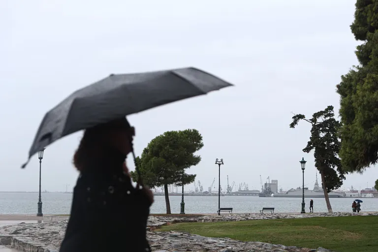
Which regions are under the highest weather alert in Greece?
Thessaly, the Sporades, Euboea, and the Dodecanese islands are currently facing the highest level of meteorological danger under a red code warning. According to the emergency bulletin from EMY for October 28, 2026, these areas are expected to experience the most violent weather phenomena, including torrential rain and significant storm activity. In Thessaly, the warning specifically covers the regional units of Magnesia and Larissa, remaining in effect until late at night.
Beyond the red code zones, a significant portion of the Greek archipelago and mainland is under orange alerts. The eastern Aegean islands are facing orange warnings until late in the evening, while parts of Eastern Central Greece—primarily the regional units of Phocis, Phthiotis, and Boeotia—are also under orange alerts that may persist through the night. In the metropolitan area of Attica and the western and northern Cyclades, orange warnings are active through the early morning hours.
Summary of Alert Levels by Region
To better understand the risk distribution across the country, the following table categorizes the warnings issued for Wednesday:
| Alert Level | Affected Regions / Units | Duration |
|---|---|---|
| Red Code | Thessaly (Magnesia, Larissa), Sporades, Euboea, Dodecanese | Until late night |
| Orange Code | Eastern Aegean islands, Eastern Central Greece (Phocis, Phthiotis, Boeotia), Attica, Western/Northern Cyclades | Varies (morning to late night) |
What is the expected weather pattern across the mainland and islands?
Widespread rain and thunderstorms are forecasted to sweep across a large portion of the Greek territory, accompanied by unseasonably low temperatures. According to the meteo forecast for October 28, 2026, the weather pattern begins with precipitation and storms primarily in Halkidiki, the eastern and southeastern mainland, the Aegean Sea, and Crete. As the day progresses, from the early morning hours, these storm systems are expected to move into parts of Macedonia and Thrace.
The intensity of these phenomena is expected to fluctuate throughout the day. While the early morning to early evening periods will see the most severe impacts in the Sporades, Cyclades, Dodecanese, and potentially Euboea and Crete, a general weakening of the weather systems is anticipated starting late in the evening. This transition suggests that while the immediate danger is high, the most volatile conditions may subside as the day concludes.
How will temperatures and wind speeds change during this storm?
Temperature drops are a defining feature of this weather event, with significant variations depending on the geographical region. In Western Macedonia, temperatures are expected to range between 1°C and 12°C, marking a sharp departure from seasonal norms. In contrast, the Dodecanese islands will remain relatively milder, with temperatures between 16°C and 20°C, while Crete will see a range of 12°C to 20°C.
Wind conditions are also expected to be quite forceful, particularly in the maritime regions. In the Ionian Sea, winds will blow from northern directions at 4 to 6 Beaufort, with gusts reaching up to 7 Beaufort during the afternoon and evening in the northern sectors. In the Aegean, northern winds will maintain a steady force of 4 to 6 Beaufort. These wind speeds, combined with heavy precipitation, increase the risk of coastal and maritime disruptions.
Regional Temperature Breakdown
The following data provides a detailed look at the expected thermal conditions across various Greek regions for October 28, 2026:
- Western Macedonia: 1°C to 12°C
- Macedonia and Thrace: 7°C to 18°C
- Thessaly: 5°C to 13°C
- Epirus: 5°C to 17°C
- Central Greece and Peloponnese: 7°C to 17°C
- Ionian Islands: 9°C to 18°C
- Northern/Eastern Aegean: 12°C to 16°C
- Cyclades: 12°C to 18°C
- Dodecanese: 16°C to 20°C
- Crete: 12°C to 20°C
What are the specific forecasts for Attica and Thessaloniki?
Attica is expected to experience rainfall and potentially sporadic thunderstorms throughout the day. The meteorological outlook for the capital indicates that winds will blow from northern directions at speeds between 3 and 5 Beaufort. Temperatures in central Athens are projected to remain between 12°C and 15°C, which is relatively moderate compared to the northern mainland but remains part of the broader storm system.
In Thessaloniki, the forecast predicts cloudy skies with intermittent local rainfall. The wind conditions in this northern hub will be slightly calmer than in the Aegean, with northwesterly winds blowing at 2 to 4 Beaufort. Temperatures in the center of Thessaloniki are expected to range from 9°C to 13°C. While the intensity in the north may not reach the red code levels seen in Thessaly, the presence of continuous cloud cover and rain necessitates caution for residents and commuters.
Will there be any snowfall in Greece?
Snowfall is anticipated in high-altitude regions of the country as the cold front moves through. According to the meteorological data, snow is expected to fall in areas with an altitude exceeding 1,200 meters. These high-altitude zones include parts of Central and Western Macedonia, Thessaly, and sections of Central and Eastern Central Greece, as well as Euboea. This indicates that while much of the country deals with rain and storms, the mountain ranges will face freezing conditions and snow accumulation.
Frequently asked questions
Which Greek islands are under the red code warning?
The Sporades and the Dodecanese islands are the primary island groups under the red code warning for October 28, 2026. These regions are expected to experience the most intense rainfall and storm activity, requiring high levels of caution from residents and travelers.
Is Attica affected by the extreme weather?
Yes, Attica is under an orange code warning. The region can expect rain and sporadic thunderstorms, with winds blowing from the north at 3 to 5 Beaufort. Temperatures in central Athens are forecast to be between 12°C and 15°C.
Where can snow be expected in Greece?
Snow is predicted for mountainous areas with elevations above 1,200 meters. This includes specific locations in Central Macedonia, Western Macedonia, Thessaly, Euboea, and parts of Central and Eastern Central Greece.
How strong will the winds be in the Ionian Sea?
Winds in the Ionian Sea will blow from northern directions at 4 to 6 Beaufort. However, during the afternoon and evening, the northern part of the Ionian Sea may see wind speeds increasing up to 7 Beaufort.
When will the storm intensity decrease?
The most intense weather phenomena are expected to begin weakening late in the evening on Wednesday, October 28, 2026. Most of the severe storm activity is concentrated in the morning and afternoon hours.
Key takeaways
- Red code warnings are active for Thessaly, Sporades, Euboea, and the Dodecanese.
- Orange alerts cover Attica, the Cyclades, and parts of Eastern Central Greece.
- Snowfall is expected in mountainous regions above 1,200 meters.
- Ionian Sea winds may reach up to 7 Beaufort during the afternoon.
- Temperatures in Western Macedonia could drop as low as 1°C.
Conclusion
The weather alert Greece has issued for October 28, 2026, signals a period of significant meteorological volatility. With red code warnings concentrated in Thessaly, the Sporades, Euboea, and the Dodecanese, the risk of flooding and storm damage is high. The combination of heavy rainfall, potential hail, and unseasonably low temperatures—reaching as low as 1°C in some areas—requires vigilant monitoring. As the storm system moves across the mainland and islands, residents in orange-alert zones like Attica should also remain prepared for localized disruptions until the weather begins to stabilize later in the evening.