What is the expected weather pattern across Greece?
The meteorological outlook for Friday, October 2, 2026, suggests a day of mixed conditions characterized by sunshine, increasing cloud cover, and localized precipitation. While much of the country will experience sunny intervals, specific regions are under alert for more severe phenomena that could impact daily activities and travel.
According to the National Observatory of Athens, sunshine will be accompanied by light cloud cover, which will increase in the eastern and southern parts of the country. Localized rain is expected in Euboea, the Sporades, and the Cyclades. Furthermore, thunderstorms are forecasted for the South Aegean, specifically impacting Crete and the Dodecanese islands. In these southern regions, particularly in the northern and mountainous areas of Crete, weather conditions are expected to intensify after the afternoon, potentially leading to more disruptive local weather.
The Hellenic National Meteorological Service (EMY) provides a similar outlook, noting that cloud cover and localized rain or thunderstorms will prevail in central and south-eastern mainland Greece, Euboea, and the South Aegean. In contrast, the rest of the country is expected to remain generally clear, with only temporary increases in cloudiness over Thrace. This contrast between the clear skies in the west and the stormy conditions in the east and south defines the day's weather profile. While the western parts of the country enjoy more stability, the eastern and southern sectors face the brunt of the incoming weather systems.
How intense will the winds be in the Aegean and Ionian seas?
Wind intensity is expected to be the most significant factor for maritime and coastal activities, with the Aegean Sea facing gale-force conditions that require caution.
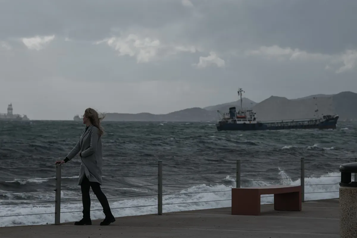
In the Aegean, winds will blow from northern directions with strength ranging from strong to nearly gale-force, measured at 6-7 Beaufort. The National Observatory of Athens warns that gusts could reach speeds between 80 and 90 km/h. This high wind activity is particularly concentrated in the eastern parts of the Aegean, where the Hellenic National Meteorological Service predicts even higher intensity, potentially reaching 9 Beaufort. Such high wind speeds can significantly affect sea states and maritime navigation, making it essential for sailors and coastal residents to monitor real-time updates.
The discrepancy between the Observatory and EMY regarding the peak intensity in the east—with EMY suggesting up to 9 Beaufort—highlights the potential for sudden, severe gusts in the eastern Aegean. These conditions are expected to be much more volatile than those in the Ionian Sea, which remains relatively calm by comparison.
Wind breakdown by maritime region
The wind patterns differ significantly between the two major sea regions of Greece, presenting different challenges for travelers and sailors:
What are the temperature variations by region?
Temperatures across Greece will show significant regional diversity, with a slight decrease noted in the southern and eastern sectors as the weather patterns shift.
In Northern Greece, temperatures are expected to range from 10°C to 25°C. However, Western Macedonia will be notably cooler, with figures between 4°C and 19°C, marking a significant dip compared to the rest of the north. This temperature drop in the northwest suggests a more pronounced influence of cooler air masses in that specific region. Central and Southern Greece will see a range of 15°C to 23°C, while Western Greece is forecasted to experience temperatures between 13°C and 26°C.
The island groups will also see variation based on their proximity to the incoming weather systems. The Cyclades and Crete will range from 18°C to 22°C, while the Eastern Aegean islands will see 16°C to 24°C, and the Dodecanese will reach 20°C to 25°C. In the Attica region, temperatures will fluctuate between 17°C and 21°C, though northern parts of the region may be 3-4°C cooler than the regional average. Thessaloniki is expected to remain between 14°C and 24°C, with light to moderate northwesterly winds (3-4 Beaufort) in the Thermaic Gulf. According to EMY, temperatures in the eastern mainland, the Cyclades, and Crete will reach 22°C to 24°C, while other areas will hover between 24°C and 26°C. These figures indicate that while the heat of summer is receding, the temperature remains mild in most parts of the country, barring the colder pockets in the north.
Where are the most severe weather alerts located?
Severe weather warnings are primarily focused on the southern islands and specific mainland coastal areas where precipitation and wind intensity are highest.
The most intense phenomena are expected in Crete and Euboea. The National Observatory of Athens highlights that after the afternoon, weather in the northern and mountainous parts of Crete will become locally intense. Similarly, Euboea may experience heavy rainfall during the midday hours. The South Aegean, including the Dodecanese, is also a primary zone for thunderstorm activity. These localized areas of high intensity are where the most immediate weather-related risks are concentrated, particularly for those in mountainous terrain or coastal zones prone to sudden changes in wind and rain.
FAQ: Weather forecast Greece
What are the wind speeds in the Aegean today?
Winds in the Aegean will blow from northern directions at 6-7 Beaufort. These are strong to nearly gale-force, with gusts reaching between 80 and 90 km/h. Some eastern areas may experience winds up to 9 Beaufort according to meteorological reports.
Will it rain in Crete and the Dodecanese?
Yes, thunderstorms are expected in both Crete and the Dodecanese. In Crete, these phenomena are predicted to become locally intense during the afternoon, particularly in the northern and mountainous regions of the island.
What is the temperature forecast for Northern Greece?
Northern Greece will see temperatures ranging from 10°C to 25°C. However, Western Macedonia will experience significantly lower temperatures, ranging from a minimum of 4°C to a maximum of 19°C.
How will the weather affect the Ionian Sea?
The Ionian Sea will experience light to moderate winds (3-4 Beaufort) from the east. After midday, the wind direction in the Central and Northern Ionian will shift to the northwest, maintaining the same moderate intensity.
Is Attica expected to be sunny?
Attica will experience sunshine with some light cloud cover. There is a possibility of localized rain in the northern and mountainous parts of the region after midday, with temperatures staying between 17°C and 21°C.
Key takeaways
- Aegean winds will reach gale-force levels (6-7 Beaufort) with gusts up to 90 km/h, potentially reaching 9 Beaufort in the east.
- Thunderstorms are forecasted for Crete, the Dodecanese, and the South Aegean.
- Crete and Euboea are at risk of intense localized weather phenomena, particularly in the afternoon for Crete and midday for Euboea.
- Temperatures in Western Macedonia will be notably low, reaching a minimum of 4°C.
Conclusion
The meteorological outlook suggests a day of significant contrast, where sunny conditions in much of the country are offset by severe wind and storm alerts in the south and east. Maritime users should prepare for high wind speeds in the Aegean, while residents in Crete and Euboea should remain vigilant for heavy precipitation. As seasonal transitions continue, these localized intense phenomena highlight the increasing variability of the Greek weather pattern in early October.