What is the current weather warning status in Greece?
The National Meteorological Service (EMY) has maintained an emergency bulletin for dangerous weather phenomena, issuing "orange" level warnings for specific southern areas. These warnings indicate a high probability of intense weather events that require caution. The most critical alerts apply to the Dodecanese islands and Crete, where meteorological conditions are expected to remain volatile throughout the day. According to the official reports, these warnings are specifically designed to alert the public to the risk of heavy rainfall and sudden thunderstorms that could disrupt daily life and safety.
Regional breakdown of orange warnings
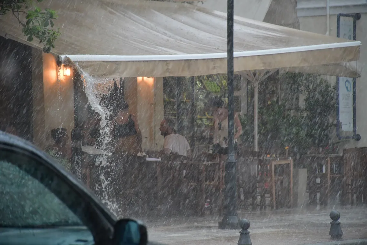
The orange warnings are specifically targeted at regions facing the highest risk of localized flooding and wind damage. In the Dodecanese, particularly around Rhodes, intense weather is expected to persist until the afternoon. Meanwhile, Crete is facing a prolonged period of instability, with the island entering its third consecutive night of heavy rainfall. Residents and local authorities in Crete have been enduring significant anxiety as the island remains caught in a new cycle of intense precipitation. These warnings serve as a vital signal to local authorities and residents to prepare for potential disruptions in travel, maritime activities, and outdoor operations.
How will the storm impact Crete and the Dodecanese?
Crete and the Dodecanese are facing the most severe impacts of the current weather system, characterized by heavy rain and significant wind speeds. According to Meteo, the rainfall and localized thunderstorms in Crete will be most intense during the morning hours, specifically affecting the northern, eastern, mountainous, and semi-mountainous parts of the island. The Dodecanese will experience similar intensity, though the window for these phenomena extends into the afternoon, with Rhodes being a primary area of concern. The combination of heavy downpours and localized storms creates a high-risk environment for these southern territories.
Wind and sea conditions in the Aegean
Beyond the precipitation, the Aegean Sea is experiencing significant wind activity. Forecasts indicate that winds in the Aegean will blow from northern directions with moderate to strong speeds of 5-6 Beaufort. During the morning hours, these winds are expected to become nearly gale-force, reaching 7 Beaufort with gusts between 70 and 80 km/h. This increase in wind speed is expected to weaken gradually as the day progresses, but the initial intensity poses significant risks for maritime operations and coastal areas. The transition from moderate to nearly gale-force conditions highlights the volatility currently present in the Aegean basin.
What is the weather forecast for the rest of mainland Greece?
While the southern islands face storms, the majority of mainland Greece will experience relatively stable and clear conditions. The National Meteorological Service predicts that the rest of the country will see generally clear skies, with only occasional cloud cover increasing in the eastern mainland regions and Evia. In Evia, local light rains are expected to occur until midday before the weather stabilizes. This creates a sharp meteorological divide between the turbulent south and the calmer mainland regions.
Temperature trends across the mainland
Temperatures across the Greek mainland are expected to show a slight increase, particularly in the eastern regions. In the western and northern parts of the country, temperatures will fluctuate between 24°C and 27°C. The rest of the country will see temperatures ranging from 22°C to 25°C. This slight warming trend provides a stark contrast to the cooler, storm-driven conditions currently affecting the southern islands, where temperatures are expected to remain lower due to the ongoing weather system.
How will temperatures vary by specific region?
Temperature variations across Greece on October 4, 2026, are significant due to the different weather systems affecting the north and south. According to Meteo, Northern Greece will see temperatures ranging from 8°C to 24°C, with Western Macedonia experiencing a much wider and more extreme range between 3°C and 21°C. Central and Southern Greece will maintain a more moderate range of 13°C to 23°C. These wide fluctuations, particularly in the north, underscore the diverse climatic conditions currently present across the country.
Specific regional temperature data
Detailed forecasts provide a granular view of the thermal conditions across the country. In Western Greece, temperatures will range from 11°C to 26°C, while the Cyclades and Crete will hover between 17°C and 22°C. The Eastern Aegean islands are expected to see between 15°C and 23°C, and the Dodecanese will range from 17°C to 22°C. In the Attica region, temperatures will stay between 15°C and 22°C, though northern parts of the region may be 3-4 degrees cooler than the rest of the area. These variations reflect the complex interaction between the regional winds and the varying degrees of cloud cover.
What are the conditions expected in Thessaloniki and the Ionian islands?
Thessaloniki is expected to enjoy sunshine with only minimal cloud cover. According to the Meteo forecast, temperatures in Thessaloniki will range from 13°C to 24°C. Wind conditions in the Thermaic Gulf will be milder, blowing from northwestern directions at weak to moderate speeds of 3-4 Beaufort. This provides a much calmer alternative to the conditions being reported in the Aegean and the southern islands.
Wind patterns in the Ionian Sea
The Ionian islands will experience different wind patterns compared to the Aegean. In the Ionian region, winds will blow from easterly directions at weak to moderate speeds of 3-4 Beaufort. Following the midday period, these winds are expected to shift to northwesterly directions while maintaining similar intensity levels. This shift in direction is a key characteristic of the local weather pattern for the day in the Ionian Sea.
Key takeaways
- Orange warnings are active for Crete and the Dodecanese due to intense rain and thunderstorms.
- Crete is experiencing its third consecutive night of heavy rainfall.
- Aegean winds may reach 7 Beaufort with gusts up to 80 km/h during the morning.
- Mainland Greece will remain mostly clear with a slight temperature increase.
- Thessaloniki is forecasted to have sunny conditions with temperatures up to 24°C.
Frequently asked questions
Which areas in Greece are under orange weather warnings?
The orange warnings are currently in effect for the Dodecanese islands and Crete. These areas are at high risk for intense rainfall, localized thunderstorms, and heavy winds. Residents and travelers in these southern regions should remain vigilant and monitor local weather updates throughout the day.
What are the expected wind speeds in the Aegean?
Winds in the Aegean will primarily blow from the north at 5-6 Beaufort. During the morning hours, they can reach nearly gale-force levels of 7 Beaufort, with gusts recorded between 70 and 80 km/h. These winds are expected to weaken gradually as the day moves toward the afternoon.
Will it rain in mainland Greece today?
Most of the mainland will remain clear with only light, passing clouds. However, Evia may experience some local light rain until midday. The eastern mainland might see slightly increased cloud cover, but significant storm activity is largely confined to the southern islands and Crete.
What are the temperature ranges for Northern Greece?
Northern Greece will see temperatures between 8°C and 24°C. In the specific region of Western Macedonia, the temperature range is much broader, dropping as low as 3°C and reaching up to 21°C. This reflects the significant thermal variation across the northern territories.
How is the weather in Attica expected to be?
Attica will experience sunshine with some light cloud cover that may increase slightly toward midday in the northern and eastern parts. Temperatures will range between 15°C and 22°C, though northern Attica may be slightly cooler by 3 to 4 degrees than the southern parts.
Conclusion
The weather in Greece on October 4, 2026, presents a tale of two climates: severe instability in the south and relative calm in the north. While the Dodecanese and Crete must contend with orange-level warnings for heavy rain and gale-force Aegean winds, the mainland and Thessaloniki can expect sunshine and rising temperatures. Travelers and residents in the southern islands should prioritize safety due to the ongoing multi-day storm cycle. As the wind speeds in the Aegean begin to subside in the afternoon, the immediate threat of intense weather is expected to diminish across the archipelago.