What is the current weather forecast for Greece?
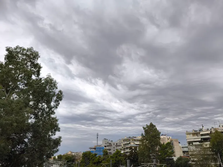
The weather across Greece remains unstable for another 24-hour period, with meteorologists predicting a transition from scattered showers to more significant weather events. As of Friday, October 30, 2026, the Meteo service of the National Observatory of Athens reports that cloud cover will be widespread, bringing localized rain to both the mainland and various island and maritime regions.
While the early hours of the day may see rain primarily on the mainland, these conditions are expected to diminish as the day progresses. However, the atmospheric stability is further compromised by the presence of African dust, which will lead to increased concentrations in the air, particularly affecting the eastern sectors of the country. This combination of moisture and airborne particles creates a complex meteorological environment for the current period.
Upcoming weather deterioration
The current instability is not a temporary fluctuation but rather the precursor to a more significant weather shift. Meteorologists have issued warnings regarding a further deterioration of weather conditions starting this coming Sunday and continuing into Monday. During this period, heavy rainfall is anticipated, with the most intense precipitation likely to strike Western Greece. Residents and travelers should prepare for more severe weather patterns as the weekend progresses.
Where will rain and thunderstorms occur today?
Rainfall and sporadic thunderstorms are expected to be concentrated in specific regions following the midday period. While the mainland will experience early rain, the intensity and frequency of these events will vary based on geographic location.
According to the latest meteorological data, sporadic thunderstorms are forecasted to occur from midday onwards in the following areas:
- The mainland regions (excluding Thrace)
- The Ionian Islands
- Crete
- The Dodecanese Islands
In major urban centers, the patterns are also specific. In Attica, cloud cover will persist, with local rain expected from midday onwards, particularly in the northern parts of the prefecture. Meanwhile, Thessaloniki is expected to see cloud cover with local rain arriving during the early evening hours. These localized events suggest that while the entire country is under an unstable pattern, the actual impact of precipitation will be unevenly distributed.
How will temperatures vary across different Greek regions?
Temperature distributions for Friday, October 30, 2026, show significant variance between the mountainous mainland and the coastal islands. The thermal range is influenced by both the cloud cover and the incoming dust particles.
The following table outlines the expected temperature ranges across the country:
The temperature in Western Macedonia remains the lowest, starting at just 3 degrees Celsius, reflecting the cooler, more continental nature of the region compared to the milder maritime climates of the islands like Crete, where temperatures can reach 21 degrees Celsius.
What are the wind conditions and dust impacts?
Wind patterns and the presence of African dust are key components of the current atmospheric instability. The wind direction and strength vary significantly between the Aegean and Ionian seas, influencing local weather perception.
In the Aegean Sea, winds are expected to blow from northern directions with a force of 3 to 5 Beaufort. In contrast, the Ionian Sea will experience winds from variable directions with a lower intensity, ranging between 2 and 4 Beaufort. In Attica, winds will also remain relatively light, blowing from the north at 2 to 4 Beaufort.
The presence of African dust is a notable feature of this weather system. The concentrations of this dust in the atmosphere are expected to be relatively high, particularly in the eastern parts of Greece. This phenomenon can lead to reduced visibility and may affect air quality, particularly for sensitive groups. The interaction between the northern winds in the Aegean and the dust transport mechanism contributes to the heightened concentrations observed in the eastern regions.
Frequently asked questions
When will the weather in Greece improve?
The current unstable pattern is expected to persist through the weekend. Meteorologists warn of a further worsening of weather conditions starting Sunday and Monday, with heavy rains expected, particularly in Western Greece, suggesting that stability may not return until after the early part of next week.
Which areas will be most affected by African dust?
African dust concentrations will be relatively high across the country, but the impact will be most pronounced in the eastern regions. This atmospheric phenomenon is part of the current unstable weather pattern affecting the Greek territory on October 30, 2026.
What is the temperature forecast for Athens?
In the center of Athens, temperatures are expected to range from 14 to 21 degrees Celsius. Residents should also expect cloud cover and localized rain, particularly in the northern parts of the Athens prefecture, starting from the afternoon.
Will there be thunderstorms in the islands?
Yes, sporadic thunderstorms are forecasted to occur from midday onwards in certain island groups, specifically the Ionian Islands, Crete, and the Dodecanese, as part of the broader unstable weather system currently moving through the country.
How strong will the winds be in the Aegean?
Winds in the Aegean Sea are expected to blow from northern directions with a strength of 3 to 5 Beaufort. This is slightly stronger than the winds in the Ionian Sea, which will range between 2 and 4 Beaufort.
Key takeaways
- Unstable weather continues in Greece with rain and African dust on October 30, 2026.
- Sporadic thunderstorms are expected from midday in the Ionian, Crete, and Dodecanese.
- A significant weather deterioration is forecasted for Sunday and Monday.
- Temperatures range from a low of 3°C in Western Macedonia to 21°C in Crete.
- African dust concentrations will be highest in the eastern parts of Greece.
Conclusion
The weather in Greece remains characterized by instability, with a combination of localized rainfall and the influx of African dust. While the immediate impact of rain may weaken during the day on Friday, the atmospheric conditions remain unsettled. The most critical aspect for residents and travelers is the upcoming forecast for Sunday and Monday, which points toward a more severe weather event involving heavy rainfall, particularly in Western Greece. Monitoring local meteorological updates from the National Observatory of Athens will be essential as the weather system evolves over the coming days.
| Region | Temperature Range (°C) |
|---|---|
| Western Macedonia | 3 to 14 |
| Macedonia, Thrace, and Thessaly | 8 to 19 |
| Epirus | 6 to 20 |
| Central Greece and Peloponnese | 9 to 21 |
| Ionian Islands | 9 to 20 |
| North and East Aegean Islands | 12 to 19 |
| Cyclades and Dodecanese | 14 to 20 |
| Crete | 15 to 21 |
| Athens (Center) | 14 to 21 |
| Thessaloniki (Center) | 12 to 19 |