When will the severe weather impact different Greek regions?
The extreme weather system is scheduled to move through the country in distinct phases, beginning with the western islands and moving toward the north and east. According to the EMY extreme weather alert, the timing of heavy rainfall and thunderstorms varies significantly by region to allow for better local preparedness.
Sunday, November 1, 2026, timeline
On Sunday, the initial wave of heavy precipitation is expected to hit the Ionian islands until midday. Following this, the focus shifts to the mainland, where Emy predicts intense rainfall in Epirus, Western Central Greece, and parts of the Western and Southern Peloponnese through the afternoon. By the late afternoon and evening, the weather pattern moves toward the north and east, affecting Central and Eastern Macedonia, the Northern and Eastern Aegean islands, and the Dodecanese.
Monday, November 2, 2026, timeline
The weather instability persists into Monday, though the geographic focus shifts slightly. The Ionian islands are expected to experience intermittent heavy phenomena starting from the morning hours. In the mainland, Epirus, Western Central Greece, and the Western Peloponnese will face intense weather from the afternoon until late at night. Additionally, the Dodecanese islands are forecasted to deal with intermittent severe weather lasting until the evening hours.
What are the specific risks according to Meteo forecasts?
Meteo provides a detailed breakdown of the meteorological risks, emphasizing that the weather will be characterized by low temperatures and significant wind speeds. The forecast highlights not only rain but also the risk of hail and atmospheric dust, which could impact visibility and safety.
The primary risks identified for the November 1st period include:
- Thunderstorms and Heavy Rain: Widespread across much of the country until midday, shifting to the north and east in the afternoon.
- Hailfall: There is a high probability of hail, particularly in maritime, island, and coastal areas.
- Wind Intensity: Winds are expected to reach up to 7 Beaufort in the Northern Aegean.
- Atmospheric Dust: Increased concentrations of dust are anticipated in the northern and eastern parts of the country.
These combined factors suggest a high-impact weather event, especially for coastal communities and those in the northern mountainous regions where temperatures will be notably lower.
How will temperatures and wind speeds vary across Greece?
Temperature fluctuations will be significant, with northern regions experiencing much colder conditions than the southern islands. Wind patterns will also vary, with the Northern Aegean seeing the most intense gusts.
In the Northern Aegean, winds will initially blow from the northeast at 3 to 5 Beaufort but are expected to shift to the southeast from midday, reaching up to 7 Beaufort momentarily. In the Central Aegean, winds will be southeasterly at 3 to 5 Beaufort, increasing to 4 to 6 Beaufort after midday. The Southern Aegean will experience southerly winds at 3 to 5 Beaufort, occasionally reaching 6 Beaufort.
What is the outlook for Athens and Thessaloniki?
Major urban centers like Athens and Thessaloniki are also under the influence of this weather system, though the timing and intensity differ from the rural and island regions.
Athens and Attica
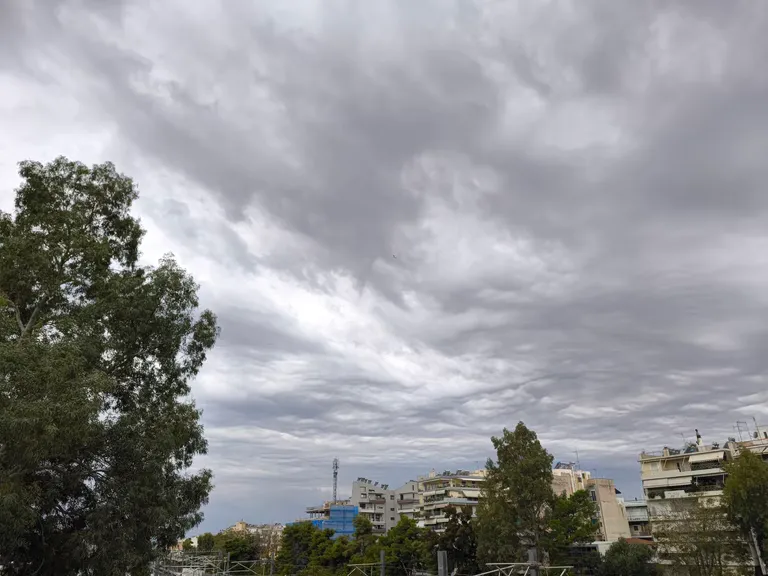
In Attica, the forecast predicts cloudy skies accompanied by rain and thunderstorms. These phenomena may become locally intense between the morning and afternoon hours. Winds in the capital will be southerly, ranging from 2 to 4 Beaufort, increasing to 3 to 5 Beaufort during the afternoon and evening. The center of Athens is expected to maintain temperatures between 15 and 18 degrees Celsius.
Thessaloniki and Macedonia
Thessaloniki will experience cloudy conditions with rain and thunderstorms. These weather events are expected to intensify from the afternoon onwards, potentially becoming severe in some areas. Winds in the region will be easterly at 3 to 5 Beaufort. Temperatures in the center of Thessaloniki are projected to fluctuate between 12 and 17 degrees Celsius.
Frequently asked questions
Which areas are most at risk for hail?
Hail is primarily expected in maritime, island, and coastal regions. These areas are most vulnerable to the sudden onset of thunderstorms that accompany the low-pressure system moving across the Aegean and Ionian seas.
When will the storm pass through Greece?
The severe weather is expected to last from Sunday, November 1, through at least Monday, November 2, 2026. The timing of the heaviest rain varies by region, with some areas seeing impact in the morning and others in the late evening.
Will there be significant temperature drops?
Yes, temperatures will be lower than seasonal averages. Western Macedonia will see the lowest temperatures, ranging from 4 to 12 degrees Celsius, while the rest of the country will see various ranges depending on the specific region.
What wind speeds should I expect in the Aegean?
Wind speeds in the Northern Aegean can reach up to 7 Beaufort. In the Central and Southern Aegean, winds will generally stay between 3 and 6 Beaufort, though local gusts may increase.
Is dust an issue during this weather event?
Yes, according to Meteo, there will be relatively high concentrations of dust in the atmosphere, specifically affecting the northern and eastern parts of Greece during this period.
Key takeaways
- Severe storms and heavy rain are forecast for Greece on November 1-2, 2026.
- The western, northern, and eastern island regions face the highest risk.
- Hail is specifically expected in coastal and maritime areas.
- Northern Aegean winds may reach up to 7 Beaufort.
- Temperatures in Western Macedonia could drop as low as 4°C.
Conclusion
The upcoming weather event in Greece presents a significant meteorological challenge for the period of November 1-2, 2026. With EMY and Meteo issuing warnings for heavy rain, thunderstorms, and potential hail, residents in the western, northern, and eastern regions should remain vigilant. The combination of gusty winds in the Aegean and unseasonably low temperatures in the north necessitates careful planning, particularly for maritime activities and outdoor travel. As the system moves from the Ionian islands toward the eastern Aegean, the varying timelines for intense precipitation highlight the need for localized monitoring of weather updates.
| Region | Temperature Range (°C) | Wind Conditions |
|---|---|---|
| Western Macedonia | 4 to 12 | Variable |
| Macedonia & Thrace | 7 to 17 | Variable |
| Thessaly | 9 to 16 | Variable |
| Epirus | 8 to 18 | Variable |
| Central Greece & Peloponnese | 10 to 19 | Variable |
| Ionian Islands | 13 to 19 | 3 to 5 Beaufort |
| Northern & Eastern Aegean | 11 to 16 | Up to 7 Beaufort |
| Cyclades | 14 to 17 | Variable |
| Dodecanese & Crete | 15 to 19 | Variable |